Project
The History of Cartography
Division of Preservation and Access

Photo caption
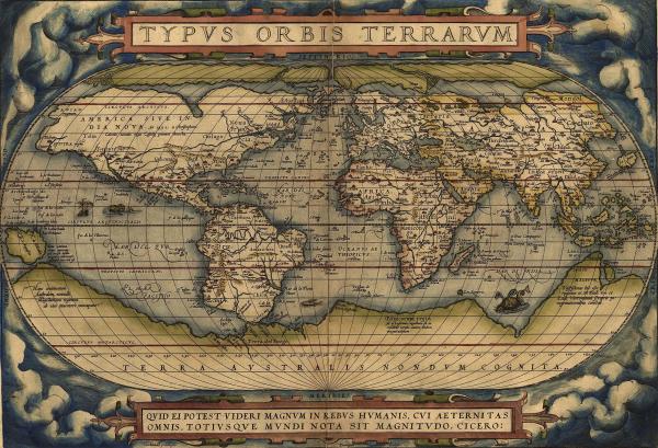
Ortelius World Map Typvs Orbis Terrarvm, 1570.
Courtesy of Wikimedia Commons

Photo caption
Ortelius World Map Typvs Orbis Terrarvm, 1570.
Courtesy of Wikimedia Commons
What do maps tell us about the societies that created them? The comprehensive History of Cartography looks at the history of maps and mapping from prehistoric times to the twentieth century. Read volumes 1-3 online.